Innovative methods for monitoring and inventory
of Danube floodplain forests
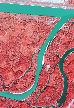
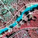
Innovative methods for monitoring and inventory of Danube floodplain forests based on 3D technologies of remote sensing is a project, which develops and broadens long-term partnership between National Forest Centre (former Forest Research Institute Zvolen) and Hungarian Forest Research Institute. Main subject of the project is to develop innovative methods and support a common approach in forest monitoring in Danube floodplain area influenced by the hydro-power plant at Gabcikovo according to mutual obligatory cross-border commitments of Hungary and Slovakia
Announcements
- National Forest Centre has launched testing operation of the INMEIN map portal
- Implementation of INMEIN project finished in December 2014. Examples and samples of the project outputs are available at the Results section.
- The INMEIN project team offers opportunity to download and use selected data from aerial survey and LiDAR scanning for research and education purposes. Please contact Dr. Ivan Sackov for access details to download the data. More information on available data can be found at the Results section.
Project objectives and outputs
 |
to improve research infrastructure – completing the remote sensing laboratories at NLC Zvolen and NYME Sopron |
 |
to coordinate the use of cross-border research infrastructure - shared use of lidar technology |
 |
to improve monitoring and forest inventory methodologies, outputs will be also exploitable in other surveys |
 |
to apply the research results in forest management - using lidar in forest management planning |
 |
to build partnership among involved institutions |